Cougar Mountain Wilderness Peak Loop
No views, but lots of big trees and pretty cascades

Quick Facts:
Location: Cougar Mountain Regional Wildland Park. Land Agency: King County Parks. Distance: 3.9 mile lollipop loop. Elevation Gain: 1200 feet. Contact: King County Parks. Green Trails Map: Cougar Mtn/ Squak Mtn No. 203S. Notes: dogs permitted on leash, Warning: car break-ins frequently occur at this trailhead—absolutely leave no valuables in your vehicle. Recommended Guidebook: Urban Trails Eastside (Mountaineers Book)
Access: Driving: From Issquah Exit 15 in Issaquah. Drive south on State Route 900 for 3.2 miles. Then turn right into the Wilderness trailhead and parking. Additional parking is available across the road at the Cougar/Squak Corridor parking lot.
Good to Know: dog-friendly, snow-free winter hike, Practice Leave No Trace Principles, old-growth, excellent trail running
Hike to Cougar Mountain’s highest summit. At just shy of 1600 feet it’s no Everest, but the two trails taking you there are named in honor for two souls who have summited the world’s highest peak. You won’t get any views—but you’ll hike through old-growth forest and along a cascading creek; and you’ll get a good workout. And although this is one of the tougher trips on Cougar Mountain, it’s also one of the more popular ones. So avoid weekends.
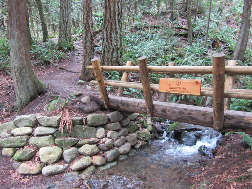
Start on the Whittaker Wilderness Peak Trail. The trail and the beautiful bridge spanning tumbling Wilderness Creek you’ll soon encounter are named in honor of Seattle native Jim Whittaker who in 1963 became the first American to summit Mount Everest. Now steadily climb through mature second growth trees adorned with clumps of ferns. The trail works its way up a steep ridge pulling away from the cascading creek. The soothing water music however is oft out played by the industrial music coming from a nearby quarry.
In a half mile cross the creek on a bridge coming to a junction at an area called “The Boulders,” for obvious reasons. You’ll be returning left, so head right on the Gombu Wilderness Cliffs Trail; named in honor of Nawang Gombu, a Sherpa who summited Mount Everest with Whittaker. Gombu’s uncle was Tenzing Norgay who along with Sir Edmund Hillary in 1953 became the first two human souls to climb the world’s tallest summit.
Soon come to another junction. Head left and continue on the Gombu Trail steeply negotiating a series of switchbacks. The way then travels along a series of mossy ledges. A second round of switchbacks soon greets you taking you through groves of some of the biggest and oldest trees on Cougar Mountain. Eventually come to a short spur leading to Wilderness Peak’s 1598-foot summit. Take it to say you done it. No views—just a bench among some big trees. Continue on the main way losing elevation and coming to Shy Bear (the kind you’d want to meet along the way) Pass.
Head left—then head left again back onto the Whittaker Trail and steeply descend through beautiful old-growth coming to a hanging valley of big mossy maples, cedars and boulders. Cross Wilderness Creek on a boardwalk and then hike above it as the creek cuts through a gorge. The trail eventually steeply drops to cross the creek and return to the “The Boulders” junction. Now head right on familiar tread returning to your start.
Cougar Mountain Wilderness Peak is one of the featured destinations in my Urban Trails Eastside (Mountaineers Book). For more a detailed description of this hike (including a map and elevation and mileage stats); and other trails in the Cougar Mountain Regional Wildland Park and throughout the Issaquah Alps and beyond, pick up a copy of this book today!
