Dash Point State Park
Make a dash for more than 10 miles of trails!
Quick Facts: Location: Federal Way Land Agency: Washington State Parks Distance: more than 10 miles of trails Elevation Gain: up to 475 feet Contact: Dash Point State Park Notes: Discover Pass required; dogs permitted on leash, Recommended Guidebook: Urban Trails Tacoma (Mountaineers Book)

Access: From I-5 exit 143 drive west on S 320th Street for 6.2 miles. Then turn right onto 47th Ave SW and drive for 0.4 mile. Next turn left onto SR 509 and continue 0.9 mile. Then turn right in Dash Point State Park and drive 0.4 mile to large parking area at Beach Day-use area.
Good to Know: Kid-friendly, dog-friendly, snow-free winter hike, Practice Leave No Trace Principles, some trails open to bikes, car camping, beach walking
Dash Point State Park contains more than 460 acres of greenery wedged between Tacoma and Federal Way. And within this sprawling park find more than 10 miles of excellent trails. From the large Day-Use Area parking you can take a path west to Dash Point’s large beach or head east for the Thames Creek (Beach) Trail to access the park’s trail network.
Many of the trails are signed, but you definitely want to take along a map. There’s a good one with mileage on the state park’s website. Also note that generally the lower trails are pedestrian only, while the upper trails allow mountain bikes. The mountain bike trails are open to hikers and runners too, but they can get busy with bikers on weekends. Thick vegetation and tight turns can make visibility tough—so be aware of bikes and opt for quieter times.
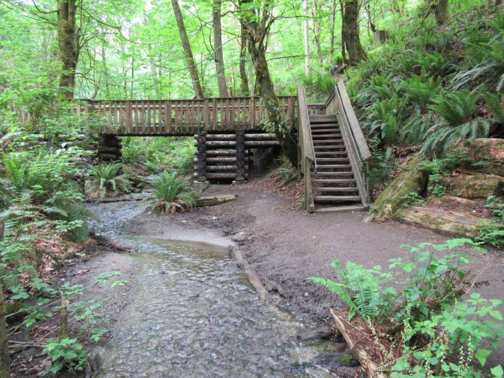
The Thames Creek Trail travels for just shy of a half mile following alongside Thames Creek in a deep emerald ravine. En route it crosses the creek on a large and elaborate bridge sure to fascinate young hikers. The trail connects the park’s campground to the Day Use area making it a popular beeline to the beach for campers.
The Old Boundary Trail takes off from the Thames Creek Trail and with its steps and steep climb out of the ravine, makes for a good workout. The Boundary Trail (which follows the old boundary of the park) connects to a series of trails in the park’s eastern reaches. South of the Boundary Trail, several trails (all open to bikes) climb the upper slopes of the park and connect to even more trails. Many of these trails are flowy. They are fun to run when not too busy with bikes. The Ridge Trail is an old logging road that traverses the hillside for a fairly level route. It’s one of the easier of the upper trails.
The Norpoint Way NE entrance is also close to “the funnel,” an interesting relic left over for when this part of the park was once used for industrial purposes. A couple of trails branch from this region to pass through land owned by the Tacoma Water District. Be sure to stay on the trail here. A run or hike around the periphery of the park will yield around 6.0 miles and a good bit of elevation gain, too.
Dash Point State Park is one of the featured destinations in my best-selling Urban Trails Tacoma (Mountaineers Book). For more details on this hike and others (including many not found in other guides), pick up a copy of this book today!
