Sasquatch Loop — Snowshoe to a Snotel on Mount St. Helens
 Quick Facts:
Location: Mount St Helens National Volcanic Monument
Land Agency: Gifford Pinchot National Forest
Roundtrip: 9.9 miles
Elevation gain: 1,000 feet
Contact: Mount St Helens National Volcanic Monument
Green Trails Map: Green Trails Mount St Helens 332S
Notes: Sno-park Pass required. Do not snowshoe in cross-country ski tracks and be aware of snowmobiles on FR 83.
Access: From Woodland (Exit 21 on I-5) follow SR 503 east for 29 miles to Cougar. Then continue east on SR 503 (which becomes FR 90) for 7.0 miles turning left onto FR 83. Follow this good paved road 6.0 miles to large Marble Mountain Sno-Park.
Good to Know: kid-friendly, cross-country skiing,
Strap on your snowshoes (or x-country skis) and traverse an open forest on a gentle bluff at the base of Mount St Helens. Catch some good glimpses of the nearby snowy volcano as well as other distant volcanoes. The Sasquatch Trails are part of a complex of winter trails on Mount St Helens’ south slopes. Situated away from avalanche zones and reached by a good paved road, they provide excellent, safe, convenient and family-friendly winter recreation.
While the Sasquatch Trails are open to both skiers and snowshoers; if you’re snowshoeing, remember not to walk in ski tracks. The trails are fairly wide, so there’s plenty of room for everyone. From the humongous trailhead parking lot, head east on the Pine Marten Trail or snow-covered FR 83 (opened to snowmobiles) for 1.8 miles to the start of the Sasquatch Trail Network. Then head left on the Sasquatch Trail following on old road track and soon coming to a junction. The old road-track continues right to eventually meet back up with the Sasquatch trail before continuing farther to terminate at FR 83.
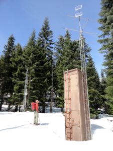
It’s more interesting (and challenging) to go left. Start climbing and reach a junction at 3.0 miles. You’ll be returning right—so head left through open forest providing views to St Helens and the Indian Heaven Country. Pass the June Lake Snotel site (elev. 3440 feet), one of many stations throughout the American west used for measuring snow packs and predicting water supply forecasts. The trail continues west through meadows before swinging north passing a good view of St Helens. The way then bends east traversing pocket meadows before gently descending.
Round a creek basin and continue through mature forest reaching an old road junction. It’s possible to follow the old track left towards the Worm Flows. The trail however follows the track right through an old harvest area reaching a junction at 6.0 miles. You can continue straight to a junction and then turn right on the lower loop to return to the first junction. But it’s more interesting turning right here on the Middle Loop instead.
Gradually ascend through open forest and wetlands passing some decent views of Mount St Helens and one good view of Mount Adams. Eventually reach a familiar junction. Turn left here and enjoy the downhill back to the Sno-Park, retracing the first 3.0 miles of your route.
For detailed information on this hike and nearly 100 others in and around Mount St. Helens, consult my (co-written with Aaron Theisen) Day Hiking Mount St. Helens (Mountaineers Books). It’s the most comprehensive book to Mount St. Helens, covering every trail in the monument including winter trails. Pick up your copy today!
For information on other things to do in the area and on where to stay, consult Northwest TripFinder.
For information on some great programs and events going on at the monument, check out the Mount St. Helens Institute

