Downey Creek — portal to famous Ptarmigan Traverse

Quick Facts:
Location: Suiattle River Road
Land Agency: Mount Baker-Snoqualmie National Forest
Roundtrip: 13.6 miles
Elevation gain: 1500 feet
Green Trails Maps: Mountain Loop Highway Map 111SX
Contact: Darrington Ranger District: Mount Baker-Snoqualmie National Forest
Notes: Northwest Forest Pass or interagency pass required
Access: From Darrington travel north on SR 530 for 7.5 miles turning right onto FR 26 (Suiattle River Road). Follow FR 26 first on pavement, then gravel 20.6 miles to trailhead located on your right just after the Downey Creek bridge.
Good to Know: exceptional old-growth; dog-friendly, Glacier Peak Wilderness, backpacking opportunities, wilderness rules apply

One of the wildest trail-accessible valleys in the North Cascades, Downey Creek is visited primarily by climbers returning from the Ptarmigan Traverse. One of North America’s classic alpine routes, this rugged off-trail traverse across rock and ice begins at Cascade Park in North Cascades National Park and finishes at Dome Peak high above Downey Creek. From there, trekkers make a brutal descent along Bachelor Creek to Downey Creek. It’s then a fairly pain free hike back to the Suiattle River Road.
Hikers need not worry about route-finding and special skills needed for glacier travel if just out exploring Downey Creek. While the elevation gain is fairly moderate, there are some ups and downs along the way into and out of steep ravines. Also in early

season expect to get your feet wet. There are several creek crossings, and a couple of them can be a little tricky. The two most intimidating crossings however are bridged including the one of Bachelor Creek just below a raging cascade. And thanks to recent work by the Washington Trails Association, this trail has received some much needed maintenance. The trail makes for a good day trip for strong hikers or an easy overnighter.
Starting at the trailhead, cross the Suiattle River Road and start climbing. Come to a trail register—and then switchback up a bench above the river soon entering the sprawling Glacier Peak Wilderness. The way then traverses steep timbered slopes high above Downey Creek. The wilderness waterway is out of sight—but not sound. Pass some impressive Doug-firs and cedars as well as younger stands of trees. At a little more than 2.0 miles drop into a ravine and come to your fist potentially difficult creek crossing.
Then climb out of the ravine and begin slowly descending toward valley bottom. At around 3.0 miles reach a spectacular section of trail right along the raging creek. Here embrace the full beauty of the wild waterway. Look up too—up the steep slopes to the west. That’s Green Mountain and if you look closely you can see its historic fire lookout teetering on its meadow shrouded summit. Then continue hiking up valley.
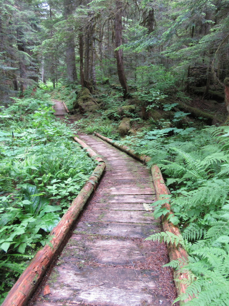
The trail passes through an impressive stand of primeval cedars and utilizes several long boardwalks across saturated sections. At about 4.0 miles come to an inviting campsite. The trail continues, coming to another foot-soaking creek crossing and more good camps. Traverse more impressive ancient forest groves. March across more boardwalks. Cross more side creeks including one rather large one—thankfully spanned by a bridge.
At 6.8 miles cross cascading Bachelor Creek on a sturdy log bridge and come to trail’s end. Here a handful of campsites are scattered tightly among big trees along a steep slope. Here too the long abandoned Bachelor Creek Trail heads straight uphill to the Ptarmigan Traverse. Your best option is drop down to the wide gravel bank on Downey Creek. Soak your feet, watch for dippers and enjoy the surrounding wilderness. After fully recharged, make the long hike back out

For more detailed information on this hike and many more in the region, pick up a copy of my brand new Day Hiking North Cascades 2nd edition. You’ll find 136 hikes in all including many other Trails Less Traveled!