Driveway Butte– Give your calves a workout hiking this steep old cattle drive

Quick Facts:
Location: Methow Valley
Land Agency: Okanogan-Wenatchee National Forest
Round Trip: 8.6 miles
Elevation Gain: 3000 feet
Contact: Okanogan-Wenatchee National Forest
Green Trails Map: Green Trails Washington Pass No. 50
Recommended Guidebook: Day Hiking North Cascades 2nd Edition
Notes: Northwest Forest Pass or Interagency Pass required
Access: From Marblemount follow State Route 20 east to the turnoff for the Klipchuck Campground (Forest Road 300) near milepost 175 (From Winthrop follow SR 20 west to the turnoff). Then drive FR 300 for 1.2 miles to the trailhead near the campground entrance.
Good to Know: dog-friendly, historic, exceptional wildflowers, practice Leave No Trace principles
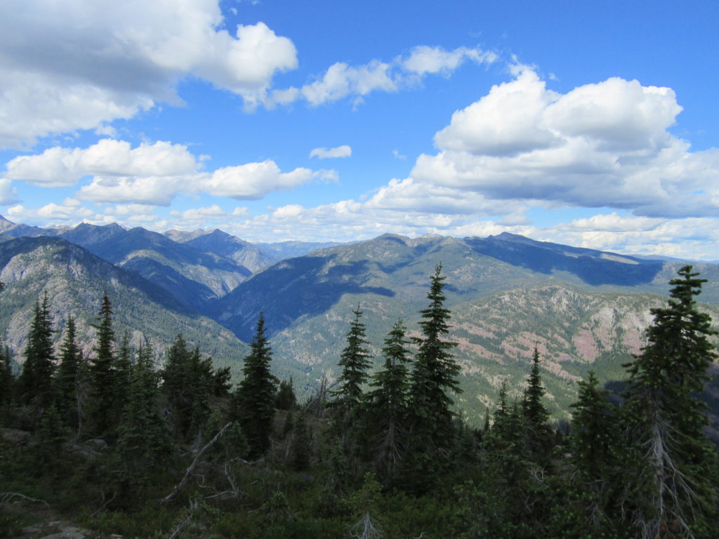
It’s a stiff climb to this old lookout site. But the views of deep glacially cut valleys ringed by glacially carved summits are superb. Melting out early, Driveway Butte makes a good early season high-country probe. In May and June half the way bursts with arrowleaf balsamroot blossoms.
Begin with a short stretch of level walking before heading up an old skid road. Through an open forest of ponderosa pine and Douglas-fir, waste no time gaining elevation. Thousands of sunflowers, as balsamroot is colloquially called in these parts, help brighten the way. The trail was once used to drive cattle to the butte’s high meadows for range, hence this peak’s name. There are no cattle left to rustle, but plenty of lizards rustle in the low brush.
After climbing steeply, the way eases as it enters what was once dense forest. Now traverse a forest of burnt snags and feisty new undergrowth thanks to a large wildfire that swept through shortly after the millennium. The trail continues through a matchstick forest, crossing—depending on the season—either a series of snowmelt streams or dry draws. Eventually emerge in meadows and parkland below the butte. The tread has faded in spots, but navigation isfairly easy. Either head straight up the open south slopes of the butte, or angle left and then right to ease the climb.
At 4.3 miles crest the 5982-foot butte. Locate the foundation of the old lookout and then start looking out. To the north, 8726-foot Robinson Mountain dominates the horizon, and Lost River is fully revealed. Look east down the Methow Valley with Goat Peak hovering above. Giants Gardner and Silver Star draw your attention southward, while the Harts Pass high country piques your interest to the west. Grouse, chickadees, nutcrackers, and bluebirds provide the score for these stunning views. While paintbrush, scarlet gilia, stonecrop, groundsel, and lupine paint the summit.

Driveway Butte is one of 136 featured hikes in my fully updated and expanded Day Hiking North Cascades 2nd Edition (Mountaineers Book). For more details on this hike and others (including many not found in other guides), pick up a copy of this book today!
For information on where to stay and on other things to do in the Methow Valley, check out Northwest TripFinder