Dirty Face Ridge– Make a clean break from Mount Townsend’s crowds
Quick Facts:
Location: Buckhorn Wilderness, Northeast Olympic Peninsula
Land Agency: Olympic National Forest
Roundtrip: 7.8 miles
Elevation gain: 3,000 feet
Green Trails Maps: Olympic Mountains East No. 168SX
Recommended Guidebook: Day Hiking Olympic Peninsula 2nd edition (Mountaineers Books) by Craig Romano
Contact: Hood Canal District, Olympic National Forest Quilcene
Access: Take US 101 to Louella Road located directly across from the entrance to Sequim Bay State Park. In one mile turn left onto Palo Alto road and continue for 6 miles to a junction. Bear right onto FR 2880; cross the Dungeness River and come to a junction in 1.7 miles. Turn left on FR 2870 and continue 12.6 miles to the Tubal Cain Trail parking lot. Park here; trail begins 0.1 mile farther on FR 2870.
Good to Know: dog-friendly, strenuous hike, good views, wildflowers, wilderness rules apply, Practice Leave No Trace Principles
Want unsurpassed Olympic Mountains views, but dread having to share them with hundreds of other hikers? Why not consider the trail-less-taken up Mount Townsend? A trail that sees more hoof prints than boot prints. A trail that can actually provide you with solitude on one of the Olympic’s most popular peaks. The trail up Dirty Face Ridge!
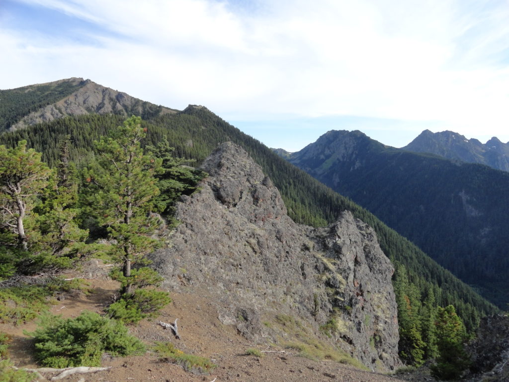
Locate the Little Quilcene Trail just beyond the Tubal Cain Mine trailhead to get you on your way up Dirty Face Ridge. There’s no time to warm-up on this path. Through a tunnel of rhododendrons reminiscent of the southern Appalachians, immediately start climbing steeply. After crossing a damp little draw, begin angling up to the ridge to the first viewpoint out to the Buckhorn peaks.
A succession of viewpoints follow as the trail rapidly gains elevation attaining the ridge crest. Enjoy precious glimpses below of the Silver and Copper Creek Valleys. Buckhorn Mountain with its twin-peaked “horns” guards the head of the emerald valleys. The Gray Wolf Ridge spans the western horizon.
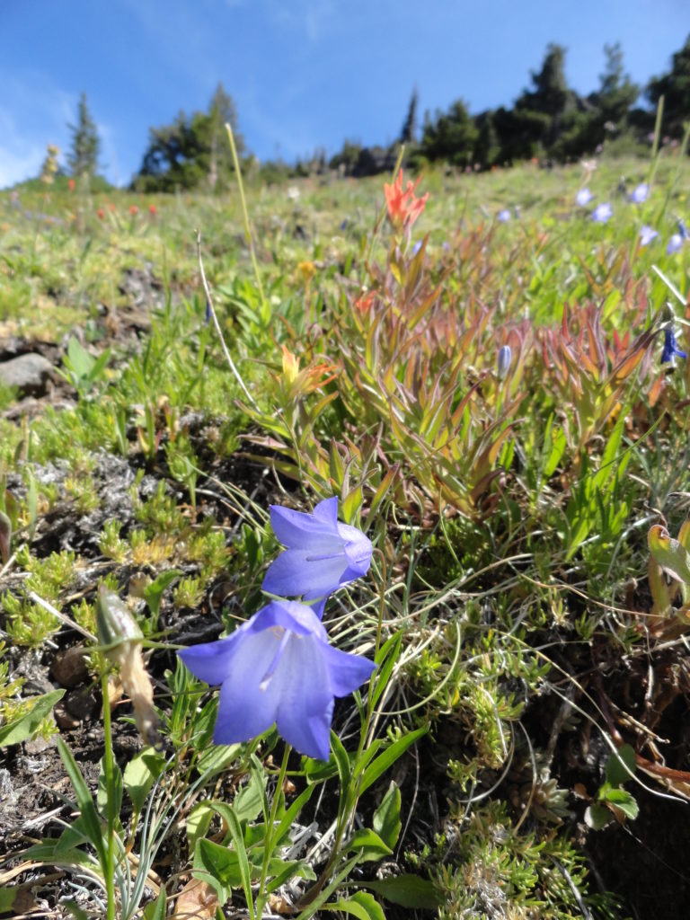
The grade eventually eases. Now alternating between pine groves and crumbling basalt ledges, the trail heads southeast towards Mount Townsend. Enjoy the floral show! Lupines line the way. Look for Piper’s bellflower, a rare Olympic endemic clinging to several of the rocky outcrops. Junipers creep along the outcrops too; common on the east slopes of the Cascades, this member of the cypress family thrives in this dry corner of the Olympic Peninsula.

At 2.0 miles, a large ledge invites lounging and is a good place to turn around if your intent was not to see anyone else on the trail. Otherwise, continue a quarter mile in cool forest coming to a junction. Solitude is now over. The Little Quilcene Trail continues left down to a popular trailhead. The Mount Townsend Trail takes off right 1.3 miles to Mount Townsend’s windswept and tundra cloaked 6,280-foot summit. Enjoy the views! This former fire lookout site provides a stunning view of Puget Sound’s plethora of islands, peninsulas, bays and coves.
And get ready to greet plenty of fellow view-seekers, too!
Dirtyface Ridge is one of 136 featured hikes in the best selling, most trusted guidebook to the trails of the Olympics; Day Hiking Olympic Peninsula 2nd edition. Get more details on this trail in the book. Pick up a copy today and discover many less traveled trails.
For more information on places to visit and where to stay and dine in the area, consult Northwest TripFinder.