Squak Mountain East Ridge– discover the quiet Issaquah Alp

Quick Facts:
Location: Issaquah Alps
Land Agency: Washington State Parks
Roundtrip: 8.0 miles
Elevation Gain: 2000 feet
Green Trails Map: Cougar Mountain/ Squak Mountain No. 203S
Contact: Washington State Parks and Mountains to Sound Greenway
Recommended Resource: Urban Trails Eastside
Notes: Dogs must be leashed.
Good to Know: snow-free winter hike, trail less taken, dog-friendly (on-leash), kid-friendly, Practice Leave No Trace Principles
Access: From Seattle follow I-90 east to Issaquah taking Exit 17. Turn right (south) onto Front Street and proceed .8 mile turning left onto SE Bush Street (two blocks south of Sunset Way intersection). Continue for two blocks to the “little yellow house,” and parking.
The quiet Issaquah Alp; Squak Mountain offers lonely roaming and the opportunity to take a hike right from town. No car? No problem—take a bus to the trailhead! While Squak’s summit is marred by an assortment of communications towers, the mountain’s mature forests, quiet ravines, and excellent trail system are this hike’s real draw. And while nearby Cougar Mountain and Tiger Mountain are awash in hikers, runners, and mountain bikers—Squak offers miles of crowd-free exploring.
There are several trails accessing this mountain. This hike is a nice suggestion right from Issaquah. Start from the “little yellow house,” headquarters of the Issaquah Alps Trails Club (which is responsible for much of the public land surrounding this sprawling suburb); and walk west on Bush Street for two blocks to Front Street. Then Walk one block south, and head west onto Newport Way crossing Issaquah Creek. Next turn left onto Wildwood Blvd SW and immediately come to the Squak Mountain Access Trail on your left. Take it following alongside Issaquah Creek coming to a small dam. Then continue through some housing complexes following signs for the “Squak Mountain Access Trail.” (Note: this section of trail may be closed to the public—if so walk Wildwood Blvd SW to Sunrise Place SW and pick up the trail again.)

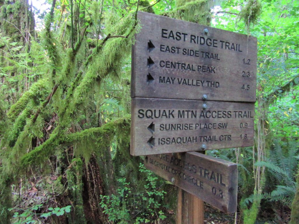
At 1.0 mile cross Sunrise Place SW and leave the urban landscape behind. Begin traversing forested slopes passing some big trees and steeply ascend. Then descend into a ravine to cross Waterfall Creek and reach a junction with the Sycamore Access Trail. This junction like most on the mountain is well-signed. Now continue right onto the East Ridge Trail and soon cross Crystal Creek on a bridge. Then begin steeply climbing—thankfully via switchbacks up a forested rib draped in salal and Oregon grape. Gaps in the forest canopy allow sneak peeks of Tiger Mountain across the valley. At 3.3 miles reach a junction with the lightly-traveled Eastside Trail.
Bear left and remaining on the East Ridge Trail reach a junction with Phils Creek Trail just beyond Thrush Gap. Head right and soon come to another junction. No go left on the Summit Trail reaching a service road after a short steep climb. Turn right onto a gravel service road and reach the multi-towered 2,024-foot Central Peak summit in 0.1 mile. The views from Squak’s highest point aren’t much if any at all, but be satisfied in having burnt some calories and enjoying some quiet trails! You can easily extend your hike by utilizing some of the connecting trails.
And as far as Squak’s unique name; the late great trail advocate Ruth Ittner once told me; “If you were stuck between a tiger and cougar, you’d squawk too!” Actually Squak is derived from the Southern Lushootseed name for snake (which also makes many a hiker squawk); and was the original name of the city of Issaquah.

For detailed descriptions (including maps) on this trail and many other trails in the Issaquah Alps, Snoqualmie Valley and surrounding communities, pick up copy of my brand new Urban Trails Eastside (Mountaineers Books).
For information on where to play and stay in and near Issaquah, consult Northwest TripFinder.