Lookout Mountain — Look out to Mount Hood and beyond
Quick Facts:
Location: Badger Creek Wilderness
Land Agency: National Forest Service
Roundtrip: 2.5 miles
Elevation Gain: 550 feet
Contact: Barlow Ranger District Mount Hood National Forest
Notes: Northwest Trail Pass or interagency pass required
Green Trails Map: Mount Hood Climbing / Timberline Trail no. 462SX
Access: From Portland: Follow I-84 east to Exit 64 in Hood River. Then follow SR 35 south for 25.7 miles and turn left onto FR 44 (Durfur Valley Road). After 3.8 miles turn right onto graveled FR 4410. Then proceed for 4.7 miles coming to a junction with FR 4420 and FR 3550. Turn left onto FR 4420 and immediately reach the trailhead for the High Prairie Trail on your right.
Good to Know: dog-friendly, kid-friendly, wildflowers, old lookout site, exceptional views, wilderness rules apply, practice Leave No Trace Principles
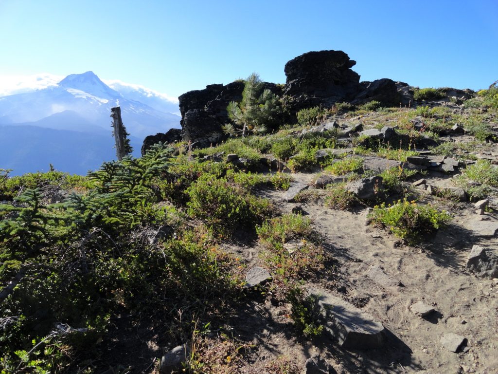
Amble across an alpine meadow bursting with resplendent wildflowers. Then gently climb to the site of a long gone fire lookout and gaze out across a sea of evergreen-shrouded ridges and sunbaked golden hillsides dwarfed by eight glacier-capped Cascades volcanoes. Oregon’s highest summit Mount Hood, steals the show—its icy summit a mere eight miles to the west. Banally but appropriately named, Lookout Mountain offers one of the best vantage points in northern Oregon for scanning the horizons. And via the High Prairie Trail, one of the best scenic payoffs for very little exertion.
Lookout Mountain can be reached via several trails, including from the Hood River Valley nearly 3000 feet below. That route through the Gumjuwac Saddle and along the Divide Trail is an exhilarating route bursting with views. It allows for access to Lookout Mountain when the higher Forest Service roads are still buried in snow. It also provides for an excellent workout and challenge with its 10 mile roundtrip and 3000 foot vertical trail stats. And it almost assuredly guarantees solitude.
The High Prairie Trail however delivers you to all the views in a mere 1.25 miles. Elevation gain is minimal, flowers during the summer are spectacular and chances of having company along the way are almost assuredly guaranteed. While this trail is one of the most popular within the Badger Creek Wilderness, it doesn’t compare at all in use to the crowded trails ringing nearby Mount Hood. High Prairie is also ideal for young children and hikers getting up there in their lifetime mileage.
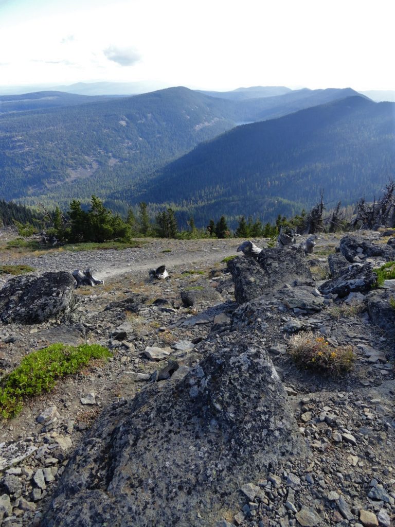
From the trailhead two trails depart. The trail to the left is the old road that once supplied the fire lookout. The trail to the right is sometimes referred to as the horse trail. Both of these trails will get you to where you want to go—so consider making a loop out of them. The High Prairie Trail to your left will deliver you higher on the mountain than the trail to the right. Both terminate on the Divide Trail from where you turn left and make the final climb to the 6523-foot summit. From 1911 until 1966 a lookout sat upon this open peak of slate ledges. Quite obvious why this post was chosen. Except for Hood in your face to the west, the views north, south and east are horizon spanning. And owing to its position in Hood’s rain shadow, sunlight often dances on this peak while raindrops descend upon Hood and its emerald neighbors.
Stare south across the 29,000-acre Badger Creek Wilderness and down to Badger Lake, one of the larger bodies of water in these parts. Then scan the horizon for Oregon’s second highest summit, Mount Jefferson and the trio of high volcanoes known as the Three Sisters. Look east to the still standing fire tower on Flag Point (which can be hiked to by continuing east on the Divide Trail). Beyond Flag Point are the golden hills of the Columbia Plateau. Now turn north and let your eyes follow the Hood River down to the Columbia River. Then look outward to the snowy giants, Mount Rainier and Mount Adams. Mount St. Helens sits slightly to the east between them.
Sunrises are spectacular from this peak. And with a short and easy descent on a wide trail you can easily plan to be on this summit for dawn’s breaking light. Star gazing is also exceptional from this peak from where you can lookout upon a landscape with minimal light pollution.
– Craig Romano, is an award winning author of more than twenty hiking guidebooks, including Day Hiking Columbia River Gorge (Mountaineers Books).