Tucannon River– Riverside trail will have you singing the Blues
Quick Facts:
Location: Blue Mountains
Land Agency: Umatilla National Forest
Roundtrip: 8.0 miles
Elevation Gain: 500 feet
Contact: Umatilla National Forest, Pomeroy Ranger District
Detailed Information: Day Hiking Eastern Washington (Mountaineers Books)
Notes: Northwest Forest Pass or Interagency Pass required
Access: From Dayton, head east on Patit Road for 14 miles turning left onto Hartsuck Grade following 4.0 miles to the Tucannon River Road. (From Pomeroy head 4.5 miles west on US 12 turning left (near Milepost 399) onto Tatman Mountain Road proceeding 9.0 miles to the Tucannon River Road). Continue south on the Tucannon River Road (which becomes FR 47) 13.2 miles to a Y-intersection. Bear left onto FR 4712 and follow this rough-at-times road 4.7 miles to its end and trailhead.
Good to Know: old-growth, wildflowers, dog-friendly, kid-friendly, practice Leave No Trace Principles
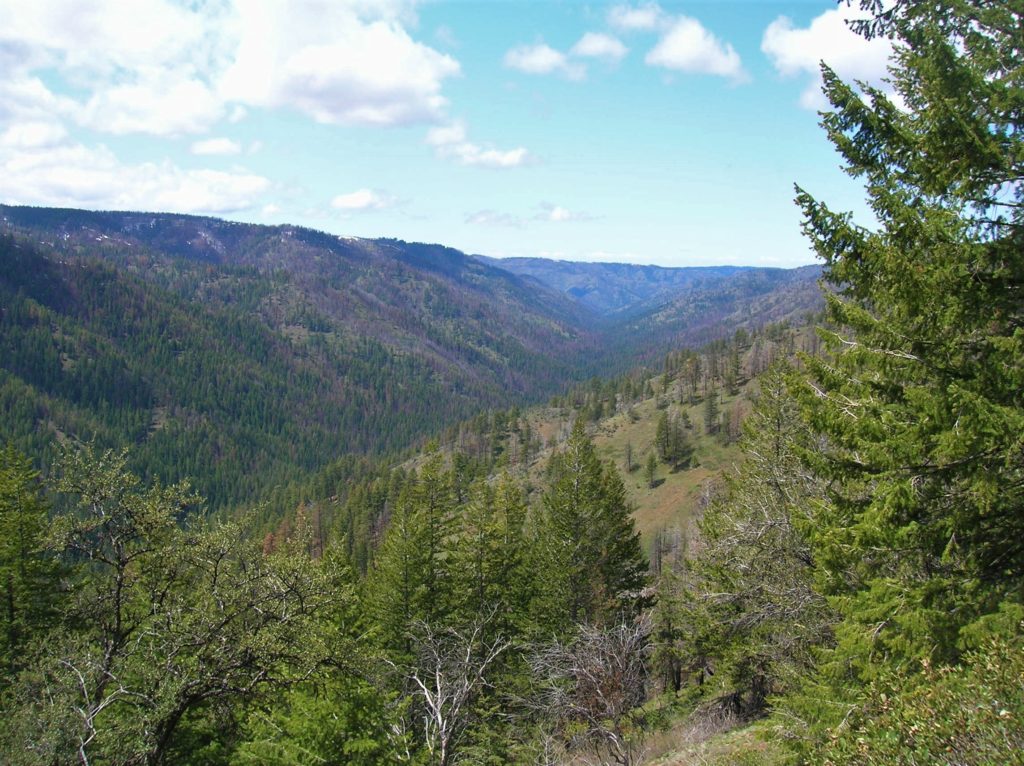
The Tucannon River Trail makes for a wonderful early season trek when the surrounding high country is still covered with snow and before the low country begins to fry in the hot Umatilla sun. But even when the mercury rises, the Tucannon River valley is graced with cool old-growth including moss-draped cedars.
Start by crossing Sheep Creek on a sturdy bridge. The way follows a recently decommissioned road for about a quarter mile before transitioning to older roadbed. Traversing a bench above the Tucannon River the trail skirts the Wenaha-Tucannon Wilderness before briefly passing through a small section of it. The 177,465 acre wilderness was created in 1978 to protect the habitat of one of the largest herds of Rocky Mountain elk. They were introduced into the region in 1913.

While most of this trail is outside of wilderness, the 12,600-acre Upper Tucannon River Roadless Area it traverses is as wild and pristine as any part of the adjacent wilderness area. The way passes through some recent burns, but plenty of towering trees survived the fires. The forest here is lush and cool—and the where sunlight penetrates the canopy to kiss southern slopes above the river—wildflowers grow in profusion. Pass through dark groves of spruce groves and open groves of pine. The river is always nearby filling the forest with water songs. Pass several riverside campsites and impressive groves of old trees.
At about 4.0 miles, just past where Bear Creek tumbles down the slopes to your south into the river, reach a junction with the Bear Creek Trail. Here the Bear Creek Trail heads left steeply climbing out of the valley; and right fording the river (difficult in early season) before also steeply climbing out of the valley—making this a good spot to turn around. However, views of the Tucannon River canyon and of lofty Diamond Peak are excellent if you venture upwards for a mile or so up the Bear Creek Trail.
Tucannon River is one of 125 featured hikes in my and Rich Landers’ Day Hiking Eastern Washington (Mountaineers Book). For more details on this hike and others (including many not found in any other guides), pick up a copy of this book—the most comprehensive and trusted guidebook on hiking in Eastern Washington—today!
For information on where to stay and on other things to do in Eastern Washington, check out Northwest TripFinder