Frenchman Coulee — This Canyon above the Columbia River C’est magnifique!
Quick Facts:
Location: Columbia River Basin
Land Agency: Washington Department of Fish and Wildlife
Roundtrip: 4.0 miles
Elevation gain: 100 feet
Contact: Washington Department of Fish and Wildlife, Columbia Basin Wildlife Area (Moses Lake)
Notes: Discover Pass required
Detailed Source: Day Hiking Eastern Washington (Mountaineers Books)
Access: Follow I-90 to Exit 143 and head north onto Silica Road driving 0.8 mile. Turn left onto Vantage Road and follow this road into Frenchman Coulee to the trailhead located on your right in 3.6 miles.
Good to Know: snow-free winter hike, kid friendly, dog friendly, spring wildflowers, practice Leave No Trace Principles
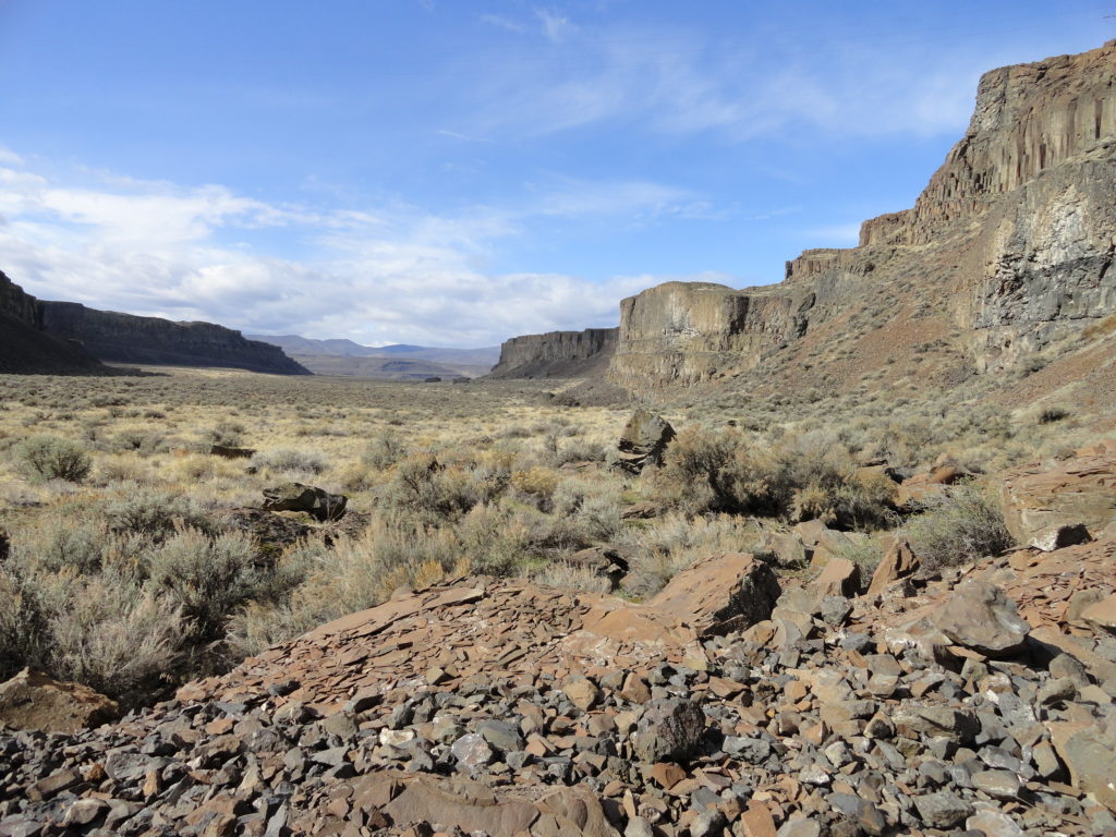
Marvel at imposing basalt walls, sculptured rocks, and a plummeting waterfall. Summer can be blistering hot and winter bone-chilling cold here in the Channeled Scablands of Eastern Washington. But spring is simply divine with agreeable temperatures, ample sunshine and a canyon floor alive with dazzling wildflowers.
Starting on a shelf at the edge of the Columbia River, head east on an old jeep track. Managed by the Washington Department of Fish and Wildlife, Frenchman Coulee is part of the multi-unit 192,000 acre Columbia Basin Wildlife Area, consisting of outstanding shrub-steppe ecosystems. A popular hunting area in fall, wildflower admirers and bird watchers flock here in the spring.
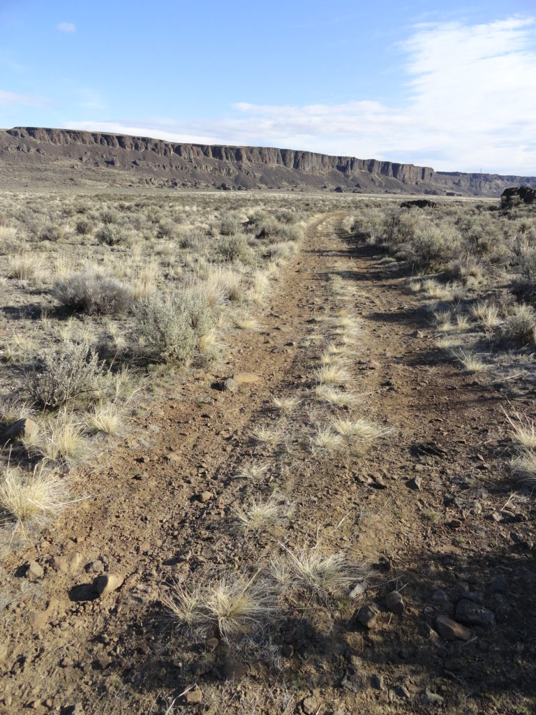
Bear right at a junction at 0.2. The trail parallels the old highway for a short distance, before the road starts climbing out of the coulee. The old jeep track stays pretty level as canyon walls flanking the north and south rise precipitously. At .8 mile continue right at another junction and skirt the base of some steep stark basalt cliffs littered with rusting car parts and other debris. Look up at the old highway blasted into ledge and spanning deep chasms. Try to envision back in the 1930s and 40s cars puttering up the highway under a scorching hot sun to soon pull over in distress, steam spouting from the radiator cap.
The tread now gets a little sandier and softer. Skirt big talus slopes harboring reptiles and small mammals. Now well below the highway and away from popular climbing spots, engine and human sounds are replaced by wind and birdsong and the falling water from the nearing cascade.
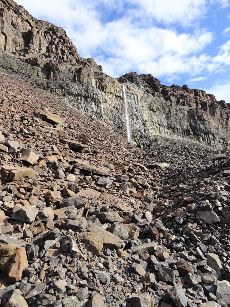
Pass beneath high tension wires and begin angling north toward a creek cascading from the coulee rim. At 2.0 miles reach the base of the cascade near a big talus slope. The flow is regulated by runoff and irrigation needs from above sometimes rendering the cascade dry. Admire ravens and raptors riding the thermals above it. Marvel too at the depth and scope of the coulee from here deep inside it. During springtime delight in the dazzling display of floral carpeting.
For detailed information on this hike and 124 others east of the Columbia River, consult my (co-written with Rich Landers) Day Hiking Eastern Washington guidebook.
For places to stay and other things to do in the Moses Lake Area, check out Northwest TripFinder.
All content and images on this site are copy written material and MAY NOT be used without the written permission of Craig Romano, owner of Hike of the Week.