Spruce Railroad Trail─A perfect hike for spring training

along the Spruce Railroad Trail.
Quick Facts
Location: Lake Crescent, Olympic National Park
Land Agency: National Park Service
Roundtrip: 8.0 miles
Elevation Gain: 250 feet
Contact: Olympic National Park; www.nps.gov/olym
Green Trails Map: Lake Crescent, No. 101
Notes: Dogs are prohibited.
Access: From Port Angeles, follow US 101 west for 17 miles turning right onto East Beach Road. Follow for 3.2 miles turning left onto Boundary Creek Road. Continue for 0.8 mile to trailhead.
Hop aboard the Spruce Railroad Trail for a scenic and historic hike along the sparkling shores of massive Lake Crescent. For four nearly flat miles saunter along one of Olympic National Park’s most alluring natural features, Lake Crescent. At nine miles long, over 600 feet deep and surrounded by steep ridges and peaks, this lake appears more like a fjord. And with a microclimate favoring warmer and drier conditions than areas just a few miles to the west, Lake Crescent is a good hiking choice on an overcast spring afternoon.
Start by hiking through an old orchard graced with big moss-draped maples. Skirt around some cabins—and then drop down toward the lakeshore to the old railroad bed. Now hike on what was once a 36 mile rail line built during World War I to haul Sitka spruce to mills in nearby Port Angeles. Sitka spruce was once coveted for airplane manufacturing. Thank God for the advent of aluminum (unless you’re a salmon!) and other alloys. Ironically, the Great War ended days before the line was completed. The Spruce Railroad did however serve commercial logging interests for 35 years. In 1981, the National Park Service converted four miles of the rail-bed into trail.
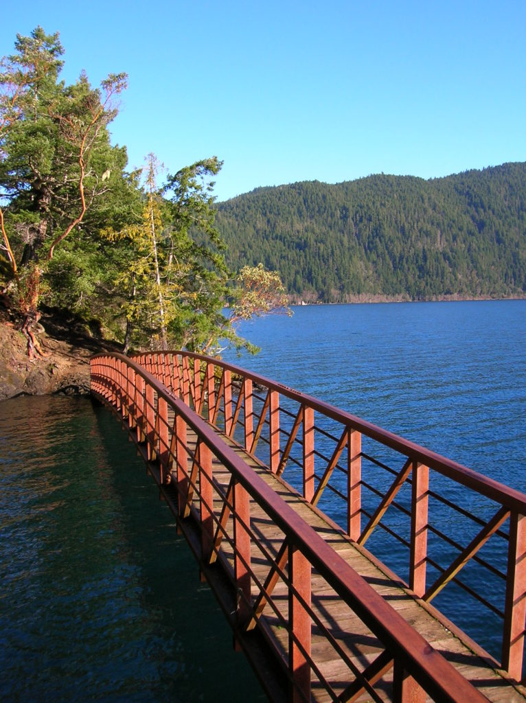
Although it runs close to the shoreline of the sparkling lake, the trail often remains high above it. Lake views are occasionally obscured by large trees. But when the trail breaks out of the canopy of giant firs and hemlocks and scaly barked contorted madronas, the views across the lake’s glimmering waters are breathtaking. You’ll reach the trail’s most scenic section, Devil’s Point and Punchbowl after only one mile of hiking. Cross the punchbowl on a spanning bridge from where you can admire the lake’s impressive depth and the lofty emerald peaks and ridges surrounding it.
Beyond the Punchbowl, the trail resumes its course above the lake. At 2.5 miles you’ll come to some good viewpoints along the lake’s narrowest section at the arch of its crescent. Directly across from you, Barnes Point, formed by river outwash, juts into the lake. Craggy Mount Storm King hovers above it.
At 3.0 miles, round a bluff where the railroad once passed through a tunnel. It’s still discernable, but advisable not to enter. You passed another old tunnel back at Devil’s Point. See if you can locate it on your return. At 4.0 miles, reach the western trailhead. Turn around and chug back to your vehicle.
For more information on this trail and over 100 others on the Olympic Peninsula, check out my Day Hiking Olympic Peninsula book.